
Walk Summary
In spite of planning the north and south ridge either side of Cwm Maen Gwynedd as two separate walks of 9.2 and 7.2 miles respectively do not consider walking these ridges (if you are fit enough to walk 13 miles) as anything other than as part of what I call the Berwyn Horseshoe. I can not imagine why I did not plan it as such in the first place.
I suppose it was to save Moel Sych & Cadair Berwyn for when I do them with Gina as part of our joint mission to visit every Historic County Top in England & Wales. However I realised two Nuttalls further along the ridge, Cadair Berwyn North Top and Cadair Bronwen were beyond Cadair Berwyn which I suspect Gina would not be keen to visit. So I decided during the drive to the walk start point to add this ridge on to the shorter Godor to Moel yr Ewig route.
Having changed the route this much it would not take much persuading to continue along the north ridge. Difficult road access from Llangollen clinched it.
This evolutionary approach to route planning produced one of the most prolific days "Nuttalling" I can remember. 11 Nuttalls in total as well as 2 additional summits which could be extended to 2 more beyond Mynydd Tarw if you have the energy.
Will return with Gina to do Moel Sych and Cadair Berwyn but will approach from the south taking the chance to visit Pistyll Rhaeadr, the highest single drop waterfall in England & Wales.
Walk Statistics |
| Sign points the way to Godor, first Nuttall of the day beyond Waen farm |
I suppose it was to save Moel Sych & Cadair Berwyn for when I do them with Gina as part of our joint mission to visit every Historic County Top in England & Wales. However I realised two Nuttalls further along the ridge, Cadair Berwyn North Top and Cadair Bronwen were beyond Cadair Berwyn which I suspect Gina would not be keen to visit. So I decided during the drive to the walk start point to add this ridge on to the shorter Godor to Moel yr Ewig route.
Having changed the route this much it would not take much persuading to continue along the north ridge. Difficult road access from Llangollen clinched it.
This evolutionary approach to route planning produced one of the most prolific days "Nuttalling" I can remember. 11 Nuttalls in total as well as 2 additional summits which could be extended to 2 more beyond Mynydd Tarw if you have the energy.
Will return with Gina to do Moel Sych and Cadair Berwyn but will approach from the south taking the chance to visit Pistyll Rhaeadr, the highest single drop waterfall in England & Wales.
Walk Date - 17 April 2015
Walkers - Steve Smith
Accommodation - Gaer Hyfryd Caravan Club Site
Start Point - Off road between Tyn-y- ffridd and Tyn-y-fedwen¹ (GR - SJ 10631 31641)
Start Time - 11:21
Finish Point - Off road between Tyn-y- ffridd and Tyn-y-fedwen¹ (GR - SJ 10631 31641)
Finish Time - 17:57
Duration - 6hrs 36mins
Average pace - 1.99mph
Distance Walked - 13.14 miles
Height Ascended - 980.67metres
¹ One of only 2 barely suitable spots.
Other walks on this trip
2015
April
17th The Berwyn Horseshoe
18th Moel Fferna & Moel yr Henfaes circular from Celyngoed
20th Gyrn Moelfre & Mynydd-y-briw
Peaks visited
Nuttalls (190W - 444E&W)
Godor (65W - 318E &W)
Godor North Top (66W - 319E &W)
Moel yr Ewig (67W - 320E &W)
Moel Sych (68W - 321E &W)
Cadair Berwyn (69W - 322E &W)
Cadair Berwyn North Top (70W - 323E &W)
Cadair Bronwen (71W - 324E &W)
Tomle (72W - 325E &W)
Foel Wen (73W - 326E &W)
Foel Wen South Top (74W - 327E &W)
Mynydd Tarw (75W - 328E &W)
Hewitts (138W - 317E&W)
Moel Sych (47W - 226E &W)
Cadair Berwyn (48W - 227E &W)
Cadair Bronwen (49W - 228E &W)
Foel Wen (50W - 229E &W)
Mynydd Tarw (51W - 230E &W)
Marilyns (158W - 1550E,W&S)
Cadair Berwyn (20W - 140E,W&S)
Deweys (241W - 427EW&S)
NONE
HuMPs (364W - 2977EW&S)
Cadair Berwyn (28W - 215E,W&S)
Historic County Tops (13W - 93E,W&S)
Moel Sych (5W - 41E,W&S)
Cadair Berwyn (6W - 42E,W&S)
Historic County Tops (13W - 93E,W&S)
Moel Sych (5W - 41E,W&S)
Cadair Berwyn (6W - 42E,W&S)
W: Wales.
E,W&S:England,Wales & ScotlandRoute
 |
| GPX can be downloaded from www.shareyouradventure.com |
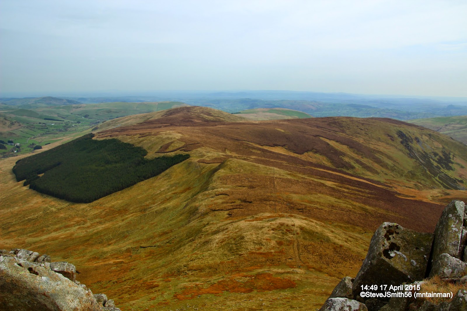 |
Godor to Moel yr Ewig ridge from Cadair Berwyn
Click on photograph to view slide-show
|