
 |
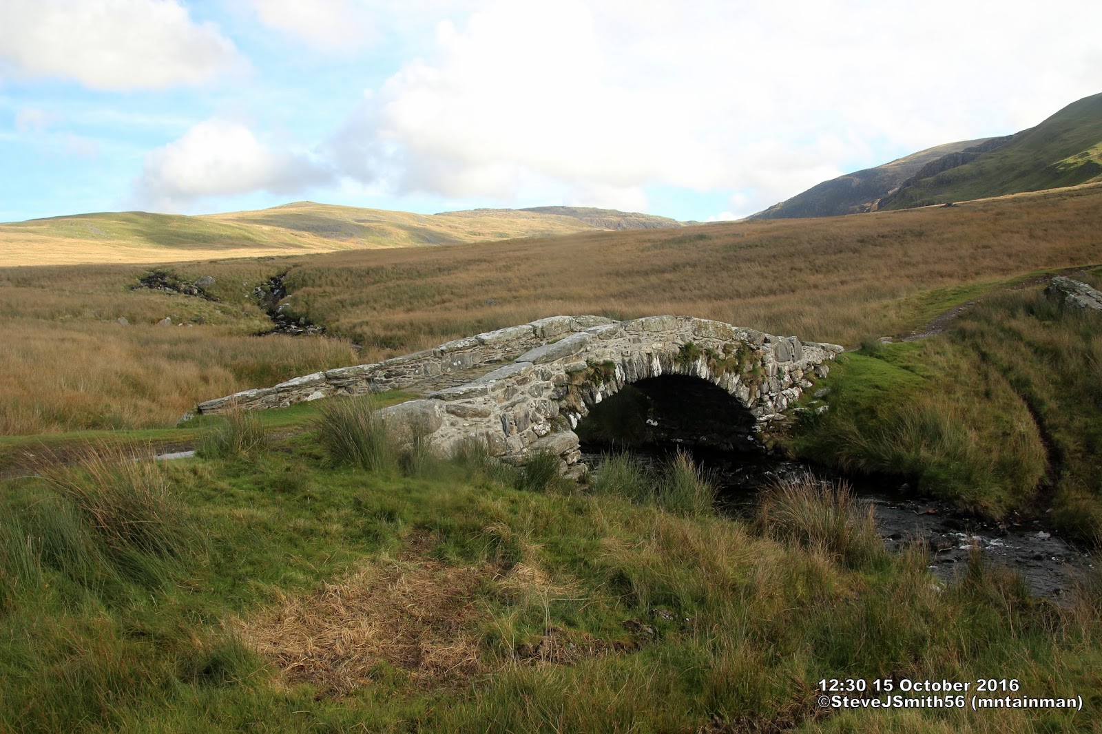
| Pont-Scethin |
 |
| Straight forward finding,following wall along established path to Diffwys and subsequent Nuttall summits |
Descent was also free range but with good visibility avoiding a couple of craggy bits heading for Pont-Scethin. From here the route becomes straight forward, simply follow the footpath up the west ridge of Diffwys West Top then follow the fence/wall to each of the days 5 Nuttalls. There was a bit of scrambling up the south side of Rhinog Fach but I am sure this could have been avoided if that is what you wanted to do.
Fine weather and good visibility made for a perfect days walking which to all intents and purposes was my last high multi-Nuttall day.
 |
| Steep descent down grassy gully on north side of Rhinog Fach |
All this took time and it was not untill 5:10pm whilst still descending Rhinog Fach that it finally twigged I would not have enough daylight to include Rhinog Fawr.
Surprising the feeling of dissapointment was minimal replaced with being reall pleased with myself that I had made the right decision assessing available daylight. Pretty certain I would not have made this decision in my early walking days.
Walk Statistics
Walk Date - 15 October 2016
Walkers - Steve Smith
Accommodation - Coed-Y-Llwyn Caravan Club Site
Start Point - Grass verge immediatly west of gate on road to Cwm Nantcol near Geli-bant (SH 62164 25848)
Start Time - 10:25
Finish Point - Grass verge immediatly west of gate on road to Cwm Nantcol near Geli-bant (SH 62164 25848)
Finish Time- 18:42
Total Duration - 8hrs 17mins
Overall Average pace - 1.52mph
Total Distance Walked - 12.60 miles
Total Height Ascended - 1335.32metres
Peaks visited
Nuttalls (189W - 444E&W)
Diffwys West Top (174W - 429E&W)
Diffwys (175W - 430E&W)
Crib-y-rhiw (176W - 431E&W)
Y Llethr (177W - 432E&W)
Rhinog Fach (178W - 433E&W)
Hewitts (138W - 318E&W)
Diffwys (124W - 304E&W)
Y Llethr (125W - 305E&W)
Rhinog Fach (126W - 306E&W)
Marilyns (158W - 1556E,W&S)
Moelfre (97W - 265E,W&S)
Y Llethr (98W - 266E,W&S)
Deweys (241W - 421E&W)
Moelfre (56W - 112E&W)
HuMPs (364W - 2975EW&S)
E,W&S:England,Wales & Scotland
Other walks on this trip
2016
October
07th Calf Top
08th Moel Siabod
09th Yr Aran & Gallt y Wenaullt
11th The Manods & Moel Penamnen from Blaenau Ffestiniog
12th The Cnichts
13th Moel Hebog - The Beddgelert Three
14th Moel-y-Gest
15th Five Nuttalls of the Central Rhinogs
18th Rhobell Fawr & Dduallt
19th Rhinog Fawr from Cwm-bychan Farm
21st Gorllwyn & Drygarn Fawr
22nd Pen y Garn
22nd Bryn y Fan
24th Foel Goch and the four Deweys from Bala C&CC campsite
25th North West Arans
Route
More Photographs
Walkers - Steve Smith
Accommodation - Coed-Y-Llwyn Caravan Club Site
Start Point - Grass verge immediatly west of gate on road to Cwm Nantcol near Geli-bant (SH 62164 25848)
Start Time - 10:25
Finish Point - Grass verge immediatly west of gate on road to Cwm Nantcol near Geli-bant (SH 62164 25848)
Finish Time- 18:42
Total Duration - 8hrs 17mins
Overall Average pace - 1.52mph
Total Distance Walked - 12.60 miles
Total Height Ascended - 1335.32metres
Peaks visited
Nuttalls (189W - 444E&W)
Diffwys West Top (174W - 429E&W)
Diffwys (175W - 430E&W)
Crib-y-rhiw (176W - 431E&W)
Y Llethr (177W - 432E&W)
Rhinog Fach (178W - 433E&W)
Hewitts (138W - 318E&W)
Diffwys (124W - 304E&W)
Y Llethr (125W - 305E&W)
Rhinog Fach (126W - 306E&W)
Marilyns (158W - 1556E,W&S)
Moelfre (97W - 265E,W&S)
Y Llethr (98W - 266E,W&S)
Deweys (241W - 421E&W)
Moelfre (56W - 112E&W)
HuMPs (364W - 2975EW&S)
Moelfre (115W - 350E,W&S)
Diffwys (116W - 351E,W&S)
Y Llethr (117W - 352E,W&S)
Rhinog Fach (118W - 353E,W&S)
Historic County Tops (413E - 93E,W&S)
NONE
Diffwys (116W - 351E,W&S)
Y Llethr (117W - 352E,W&S)
Rhinog Fach (118W - 353E,W&S)
Historic County Tops (413E - 93E,W&S)
NONE
W: Wales.
E,W: England & Wales. E,W&S:England,Wales & Scotland
Other walks on this trip
2016
October
07th Calf Top
08th Moel Siabod
09th Yr Aran & Gallt y Wenaullt
11th The Manods & Moel Penamnen from Blaenau Ffestiniog
12th The Cnichts
13th Moel Hebog - The Beddgelert Three
14th Moel-y-Gest
15th Five Nuttalls of the Central Rhinogs
18th Rhobell Fawr & Dduallt
19th Rhinog Fawr from Cwm-bychan Farm
22nd Pen y Garn
22nd Bryn y Fan
24th Foel Goch and the four Deweys from Bala C&CC campsite
25th North West Arans
Route
 |
GPX can be downloaded from
|
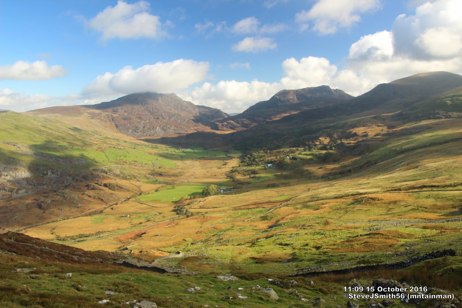 |
Looking down to Cwm Nantcol on way up Moelfre north ridge. Rhinog Fawr cloud capped, Rhinog Fach to the left then Y Llethr left of that
Click on photograph to view slide-show
|