
Walk summary
Today's three routes will see 20 of the 23 Marilyns of Area 38: The Welsh Borders climbed this month over two trips as part of rehabilitation and progression on to the next stage, which will be a return to summits over 2000' and resumption of visiting all of the English & Welsh Nuttalls.
One of the remaining three is The Wrekin which I will pick up on a subsequent trip to or from North Wales. The other two; Brown Clee Hill and Worcestershire Beacon have been deliberately left to complete with Gina as part of our joint English and Welsh Historic County Tops experience.
A total of 19 walks covering 41.73 miles and 2752m of ascent characterised mostly by short walks (averaging just over 2 miles each) with a couple of routes of 7 miles (Wapley Hill & Shobdon Hill) and 5 miles (Beacon Hill) to extend limits and test recovery and after effects.
Beacon Hill is not included in one of the above 19 walks as it is actually in Wales and is the reason why these three hills are being walked on the last day in Shropshire rather than the first, three days ago. Although Beacon Hill was unplanned it served to show I can cope with unexpected tougher walks, preparing me for when I may have to extend myself towards and beyond expected limits. It also has had the desired effect of a relatively easy day today ahead of tomorrows rest day before taking on the perceivably harder Nuttall routes on Friday and Saturday.
Personally I am one that likes to test myself to my limits and even slightly beyond, but what I have learned is that you do not have to do it every time you go out. Most importantly you should only exceed them slightly (unless you have to) otherwise you may go too far and break yourself as I did earlier in this year.
Not my quote but one I refer to:-
You do not know your limits until you approach and occasionally exceed them thereby extending your limits.
Peaks visited
Nuttalls (254E - 443E&W)
NONE
Hewitts (179E - 316E&W)
NONE
Marilyns (175E - 1550E,W&S)
Barrow (91E - 164E,W&S)
View Edge (92E - 165E,W&S)
Callow Hill (93E - 166E,W&S)
Deweys (181E - 422EW&S)
NONE
HuMPs (444E - 2975EW&S)
Other walks on this trip
2015
October
26th Walton Hill + Titterstone Clee Hill & Beacon Hill
27th North Shropshire Marilyns
28th Remaining South Shropshire Marilyns
30th Foel y Geifr ridge
31st Five Nuttalls from Pen y Boncyn Trefeilw to Y Groes Fagl
November
02nd Foel Cwn-Sian Llŵd & Post Gwyn
Walk Statistics
Walk Date - 28 October 2015
Walkers - Steve Smith
Accommodation - Greenway Touring Park
Start Point - Various. See maps below
Finish Point - Various. See maps below
Total Duration - 2hrs 34mins
Overall Average pace - 1.80mph
Total Distance Walked - 4.61 miles
Total Height Ascended - 372.56 metres
Burrow
0.23 miles, 3.86m ascent.
Expected to be able to park in St. Mary's church car park in Hopesay but lack of a car park forced me to park near the churchyard gate. Not the best of places really especially as I was blocked in on my return. I had managed to choose the one day they were changing the central heating boiler in the church. Maybe I would have been better parking elsewhere in the village. I did apologise for any inconvenience caused but the guy told me it was not a problem as it had only made access more difficult. I guess he was being sarcastic.
Picking up the Shropshire Way as it passes the church I came across a permissive path that cut a good corner off the planned route which took me to the wood boundary that covers Burrow summit. Contouring round to the south brings you to the only entrance through the fenced summit area which is a well preserved Iron Age fort. It always makes me think what went on within the concentric ramparts more than 2500 years ago. Unfortunately it was quite misty so the views where somewhat restricted however it did add to the appreciation of what it might have been like to defend the ramparts as you looked down into the misty void imagining hoards of pagans attacking from below.
View Edge
1.62 miles, 172.66m ascent.
Lack of marked paths on the OS1:25000 suggested this may be a difficult summit to access and return by means of a circular route. Lack of parking at the planned start point near Viewedge Farm also suggested it might not be a straight forward up and down route either. As it turned out limited parking further along the road to Aldon just past Viewedge Farm was available near the gate to View Edge Quarry SSI. Followwing one of the many paths took me to the SSI boundary within site of View Edge summit diagonally opposite the other side of the field. Not knowing if there was public access, but the gap in the fence suggested there was, I stuck to the field boundary then headed towards the summit as I approached the top of the field. From a distance it looked like the high point was actually in the field but upon reaching the fence it was obvious the summit was within View Wood. Stepping over a low fence took me within striking distance of the summit, so after photos, logging and GPS checking I looked to head down and find the public path from Viewedge Farm. The landowner had thoughtfully put a crossing point on the fence so it was just a matter of finding the path through the wood until it reached the public right of way and following it to the road, turn left past Viewedge Farm and return to the van.
 |
| Looking towards Church Stretton and Caer Caradoc from Callow Hill |
One of the remaining three is The Wrekin which I will pick up on a subsequent trip to or from North Wales. The other two; Brown Clee Hill and Worcestershire Beacon have been deliberately left to complete with Gina as part of our joint English and Welsh Historic County Tops experience.
A total of 19 walks covering 41.73 miles and 2752m of ascent characterised mostly by short walks (averaging just over 2 miles each) with a couple of routes of 7 miles (Wapley Hill & Shobdon Hill) and 5 miles (Beacon Hill) to extend limits and test recovery and after effects.
Beacon Hill is not included in one of the above 19 walks as it is actually in Wales and is the reason why these three hills are being walked on the last day in Shropshire rather than the first, three days ago. Although Beacon Hill was unplanned it served to show I can cope with unexpected tougher walks, preparing me for when I may have to extend myself towards and beyond expected limits. It also has had the desired effect of a relatively easy day today ahead of tomorrows rest day before taking on the perceivably harder Nuttall routes on Friday and Saturday.
Personally I am one that likes to test myself to my limits and even slightly beyond, but what I have learned is that you do not have to do it every time you go out. Most importantly you should only exceed them slightly (unless you have to) otherwise you may go too far and break yourself as I did earlier in this year.
Not my quote but one I refer to:-
You do not know your limits until you approach and occasionally exceed them thereby extending your limits.
Peaks visited
Nuttalls (254E - 443E&W)
NONE
Hewitts (179E - 316E&W)
NONE
Marilyns (175E - 1550E,W&S)
Barrow (91E - 164E,W&S)
View Edge (92E - 165E,W&S)
Callow Hill (93E - 166E,W&S)
Deweys (181E - 422EW&S)
NONE
HuMPs (444E - 2975EW&S)
Barrow (147E - 240E,W&S)
View Edge (148E - 241E,W&S)
Callow Hill (149E - 242E,W&S)
Historic County Tops (49E - 93E,W&S)
NONE
View Edge (148E - 241E,W&S)
Callow Hill (149E - 242E,W&S)
Historic County Tops (49E - 93E,W&S)
NONE
W: Wales.
E,W&S:England,Wales & ScotlandOther walks on this trip
2015
October
26th Walton Hill + Titterstone Clee Hill & Beacon Hill
27th North Shropshire Marilyns
28th Remaining South Shropshire Marilyns
30th Foel y Geifr ridge
31st Five Nuttalls from Pen y Boncyn Trefeilw to Y Groes Fagl
November
02nd Foel Cwn-Sian Llŵd & Post Gwyn
Walk Statistics
Walk Date - 28 October 2015
Walkers - Steve Smith
Accommodation - Greenway Touring Park
Start Point - Various. See maps below
Finish Point - Various. See maps below
Total Duration - 2hrs 34mins
Overall Average pace - 1.80mph
Total Distance Walked - 4.61 miles
Total Height Ascended - 372.56 metres
Burrow
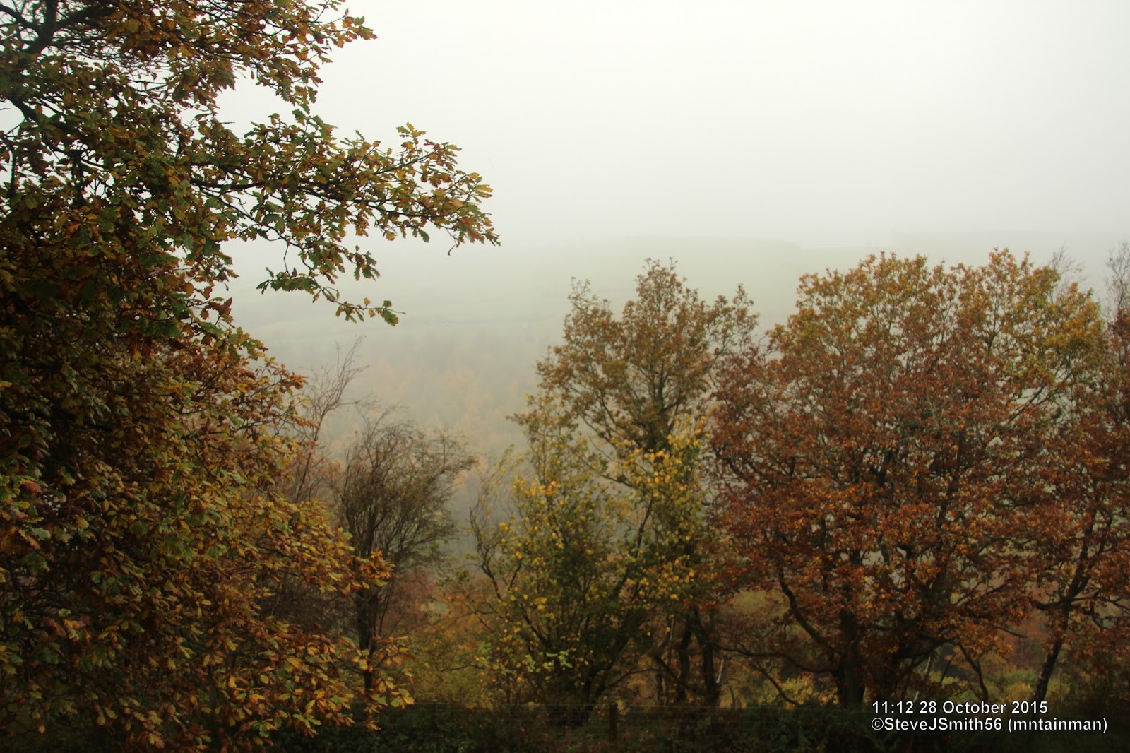 |
| Misty view to the west from Burrow hill fort ramparts
Click on photograph to view slide-show
|
 |
| GPX can be downloaded from www.shareyouradventure.com |
Expected to be able to park in St. Mary's church car park in Hopesay but lack of a car park forced me to park near the churchyard gate. Not the best of places really especially as I was blocked in on my return. I had managed to choose the one day they were changing the central heating boiler in the church. Maybe I would have been better parking elsewhere in the village. I did apologise for any inconvenience caused but the guy told me it was not a problem as it had only made access more difficult. I guess he was being sarcastic.
Picking up the Shropshire Way as it passes the church I came across a permissive path that cut a good corner off the planned route which took me to the wood boundary that covers Burrow summit. Contouring round to the south brings you to the only entrance through the fenced summit area which is a well preserved Iron Age fort. It always makes me think what went on within the concentric ramparts more than 2500 years ago. Unfortunately it was quite misty so the views where somewhat restricted however it did add to the appreciation of what it might have been like to defend the ramparts as you looked down into the misty void imagining hoards of pagans attacking from below.
 |
| Convenient fence crossing from View Edge summit area
Click on photograph to view slide-show
|
 |
| GPX can be downloaded from www.shareyouradventure.com |
Lack of marked paths on the OS1:25000 suggested this may be a difficult summit to access and return by means of a circular route. Lack of parking at the planned start point near Viewedge Farm also suggested it might not be a straight forward up and down route either. As it turned out limited parking further along the road to Aldon just past Viewedge Farm was available near the gate to View Edge Quarry SSI. Followwing one of the many paths took me to the SSI boundary within site of View Edge summit diagonally opposite the other side of the field. Not knowing if there was public access, but the gap in the fence suggested there was, I stuck to the field boundary then headed towards the summit as I approached the top of the field. From a distance it looked like the high point was actually in the field but upon reaching the fence it was obvious the summit was within View Wood. Stepping over a low fence took me within striking distance of the summit, so after photos, logging and GPS checking I looked to head down and find the public path from Viewedge Farm. The landowner had thoughtfully put a crossing point on the fence so it was just a matter of finding the path through the wood until it reached the public right of way and following it to the road, turn left past Viewedge Farm and return to the van.
Callow Hill
2.36 miles, 148.55m ascent.
Checking the nature information board near walk start point I noticed some useful route information giving me a choice between difficult route and easy route. Either way it was not very far and as I had chosen to start from Hope Dale rather than walk from Greenway campsite it did not seem unreasonable to stick with character and take the difficult option. What I had not bargained for was the really difficult option brought about by old eyes and not being able to determine or check carefully which side of the fence the path was shown on the map. Instead I was seduced through the gate where the choice between easy and difficult was made and headed up the right side of the fence rather than the left. The apparent path continued up the right side until a clearing just below Flounders Folly and although the plantaion had been cleared the path vered away to the right. Abandoning the path and heading uphill brought me to overgrown undergrowth and brambles which no doubt would have been much worse earlier in the year if autumn die back and not already begun. Although the tower was almost in touching distance it took 10 minutes and several scratches before reaching the path and the gate which led to Flounders Folley and Callow Hiull summit. Further to the west was the trig point which could not be ignored then a return to the tower and return to the van via the easy route.
 |
| Tangled undergrowth and brambles to battle through before gaining Callow Hill summit
Click on photograph to view slide-show
|
 |
GPX can be downloaded from www.shareyouradventure.com |
Checking the nature information board near walk start point I noticed some useful route information giving me a choice between difficult route and easy route. Either way it was not very far and as I had chosen to start from Hope Dale rather than walk from Greenway campsite it did not seem unreasonable to stick with character and take the difficult option. What I had not bargained for was the really difficult option brought about by old eyes and not being able to determine or check carefully which side of the fence the path was shown on the map. Instead I was seduced through the gate where the choice between easy and difficult was made and headed up the right side of the fence rather than the left. The apparent path continued up the right side until a clearing just below Flounders Folly and although the plantaion had been cleared the path vered away to the right. Abandoning the path and heading uphill brought me to overgrown undergrowth and brambles which no doubt would have been much worse earlier in the year if autumn die back and not already begun. Although the tower was almost in touching distance it took 10 minutes and several scratches before reaching the path and the gate which led to Flounders Folley and Callow Hiull summit. Further to the west was the trig point which could not be ignored then a return to the tower and return to the van via the easy route.